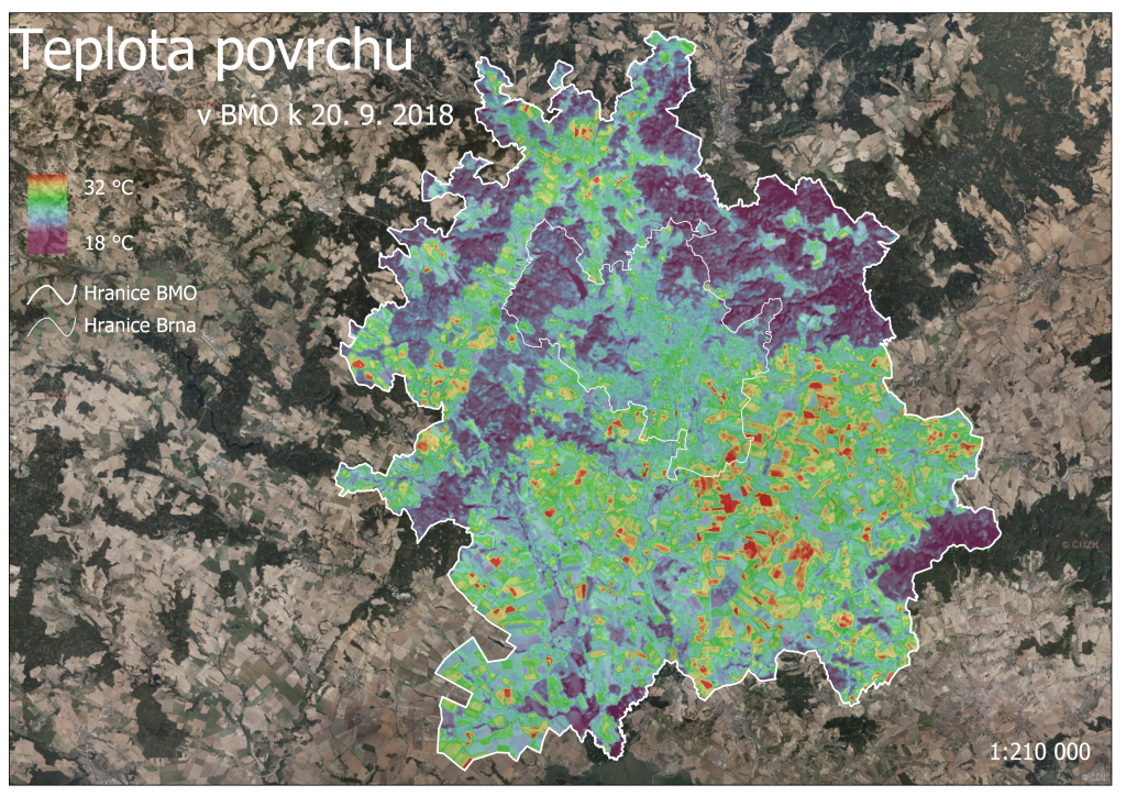
We have prepared for you the temperature map of the Brno Metropolitan Area. What can we find out in the map?
The biggest heat is in the southeastern part of the Brno Metropolitan Area, where are larger open areas without denser vegetation used for agricultural purposes. On the other hand, in the northeast (towards the Moravian karst) it is colder mainly due to the large number of forest areas.
Areas with the highest temperature are assumend to have greater problems with drought. These problems can be solved in the next programming period through the ITI tool, which has the ambition to address environmental risks.
The map was created in cooperation with the Data, Analyzes and Evaluations Department of the City of Brno. The images come from September 20, 2018, and were taken from a Landsat 8 satellite, which allows electromagnetic radiation to be captured from the surface.
Register your e-mail address to receive regular updates from the Brno Metropolitan Area.

